The California Station Fire devastated a popular backcountry area of the Angeles National Forest. But there’s hope that it can come back to its original beauty.
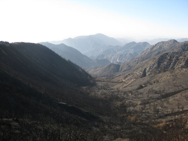
It didn’t just destroy homes, it destroyed the stability of everything in its path, until new vegetation takes root and grows. Yes, good people fought it; bad people caused it. Everybody watched it, either on the news or in the front yard. It was horrendous in some senses, but it is also the course of nature whether humans cause it or not.
They call it the Station Fire. It began August 28, 2009 and raged until October 16. The blaze devoured a total of 160, 577 acres making it the largest fire in Los Angeles County history and the tenth largest in California history. The wildfire claimed the lives of two Cal Fire firefighters. The Angeles National Forest Service was forced to close the majority of roads and trails in the area. As a result, the outdoor lifestyles of many Southern Californians have suffered.
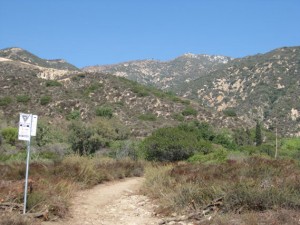
Many of the trails in the front range of the San Gabriel Mountains were spared from the fire. Some of these trails include local favorites such as the Sam Merrill Trail, Mount Lowe Railway, and the Castle Rock Trail leading to Inspiration Point. These trails were closed by the National Forest Service for safety concerns well into the end of October and early November. These trails can be quite crowded on the weekends and such crowds have nearly doubled in size since the trails were reopened.
Hikers in the Southern California (especially the San Gabriel Valley) have been left with fewer options when choosing trails for weekend hikes. Many of these hikers either hike the remaining available trails or seek trails outside of the immediate area in places such as Orange County, San Bernardino, or Riverside County.
The most popular hiking trail in the area is the 2.7 mile Sam Merill trail located just north downtown Pasadena. Hikers who wish to extend their journey usually hike the connecting Castle Rock Trail to Inspiration Point. Many local residents were relieved to find that this entire route had been untouched by the Station Fire. And that’s the good news. Here, the trails are somewhat steep with many switchbacks which wind up through the canyons and mountain passes.
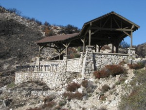
The Sam Merrill is roughly 2.5 miles long and forks into several connecting trails. The trail leads to the site of an old hotel which once overlooked Pasadena in the early 20th century. The hotel was short lived and had been destroyed by a fire not long after its opening. The remains left standing are quite impressive and provide a spectacular photo backdrop along with the breathtaking views of the San Gabriel Valley.
Hikers who want to travel further into the San Gabriel front range can continue along the connecting trails which include the Mount Lowe Railway and the Castle Rock Trail. The Castle Rock Trail is a challenging but enjoyable trail intended for the more adventurous hikers. The trail itself is only about two feet wide and winds alongside a steep slope. It is beset on both sides by dense green vegetation. The trail passes through a stream and several shaded coves. Hikers must trudge through a small stream, climb over a couple small boulders, and crawl under a fallen tree to complete the trip. The trail seems a bit precarious at times but the picturesque views are worth the effort. The trip is about 4.7miles long and overlooks Pasadena into the Los Angeles Basin. One can sometimes see out to Catalina Island on clear day.
The Castle Trail is about two miles in length and ends at the spectacular Inspiration Point. The spot lives up to its name as it has an observation post consisting of an overhang, benches, and lookout point. Inspiration Point looks out over the green (by late November 2009) hillsides of the San Gabriel front range, Pasadena, and the Los Angeles Basin to the south.
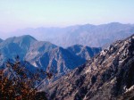
However, the view to the north was once a spectacular sight consisting of luscious green peaks and valleys leading deep into the Angeles National forest. Today, the views to the north of Inspiration Point are eerily different.
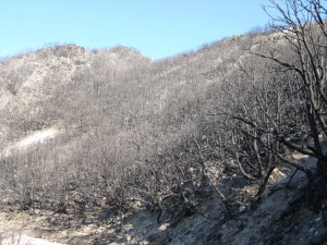
Inspiration Point is located along a fire road leading deeper into the mountains. This fire road was the front line for fire crews battling the Station Fire. This can be seen as there is an obvious contrast in the vegetation on either side of the road. The south side of the road is full of green, thriving vegetation while the north side is a charred and horrific moonscape. The peaks and valleys once full of green shrubs, wildflowers, and eucalyptus and pine trees now consist of rolling hills of ash covered with forests of blackened gnarled tree trunks.
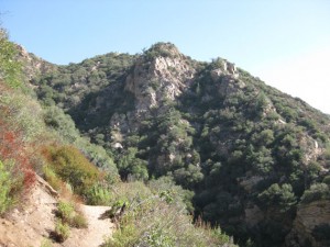
We met with a great deal of hikers on the way up the Sam Merrill Trail to the old hotel. Many of the hikers did not want to brave the more difficult Castle Rock Trail and wanted to enjoy the park-like setting in the front range. Many were as relieved as we had been that the Sam Merrill was untouched by the fire.
Very few had any desire to explore any further and see any more of the burn area. As we traveled along the Castle Trail, we met with a young couple carrying a camera and tripod who claimed that they were returning from Inspiration Point as they had been taking pictures of the burn area. They said they found a unique beauty in such a sight as a charred forest (deviates!)
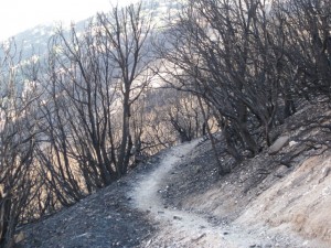
Although the handful of people we met at the top at Inspiration Point did not share the couple’s enthusiasm, but claimed they had had an interest in seeing the devastation the fire had caused. Most agreed that they preferred the luscious green peaks and valleys as opposed to the scorch and burn policy implemented by arson.
Hikers are advised to steer clear of the recently burned areas for a number of safety concerns. The National Forest Service is currently surveying the area for potential hotspots that may flare up. Fire crews have identified and dowsed several hotspots near Mt. Wilson since early November.
Many trails and roads in the Angeles National Forest are still closed to keep hikers clear of any danger of hotspots and to prevent any interference with fire crews. There is also a higher chance of landslides in the upcoming months in the burn area. Vegetation holds soil in place and helps prevent erosion. There is a higher chance that this soil will erode as much of the vegetation no longer holds it in place. Winter rains loosen much of this soil causing a great deal of erosion.
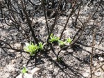
Wildfires such as the Station Fire are also devastating to nearby populations as they destroy homes and other structures, burn beautiful settings for outdoor activities, and threaten wildlife. Southern California is accustomed to wildfires, and local vegetation and wildlife have adapted to these disasters throughout history.
Southern California is a chaparral habitat which is characterized by a wet and cold winter season and a very hot and dry summer season. The cold temperatures of the winter and hot temperatures of summer make it very difficult for decomposers such as bacteria, mold, and fungus to thrive. This causes an accumulation of excess brush that comprises the chaparral. These habitats are in fact dependent on wildfire to act as a decomposer and clear the way for future generations of vegetation.
Wildfires have raged in the chaparral for thousands of years and the vegetation has adapted to survive in such a habitat. Many plants native to Southern California require fire to help spread and germinate seeds. Some plants require nitrogen dioxide produced in brushfires to help germinate seeds. Other native plants have fire resistant stems and roots which survive the flames and sprout within a few weeks after the fire has cleared.
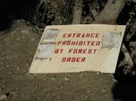
So it is important for hikers and wild land visitors to areas prone to wildfires to have a basic understanding of wildfire behavior, safety, and dangers. Check the wildfire status of trails before hikes. Hikers can view various websites for fire warnings. Signs are often displayed at trail heads which warn hikers of the wildfire threat level for that day. Fire season in Southern California lasts from March through October. Hikers should never hike when there is any fire burning, even if the fire is miles from the hike. Wildfires are known to cast fiery debris into the air which land and ignite new fires miles from the original blaze.

It is strongly recommended that Southern Californians avoid outdoor activities in the areas of the Angeles National Forest affected by the Station Fire until the Spring of 2010. The winter rains will help ensure that hotspots die out and loose soil left behind by the fire has eroded away. The spring will give rise to the next generation of vegetation and add a bit of green to the current moonscape in the mountains. Southern Californians have many options for outdoor activities until next Spring including hiking in surrounding areas such as the Santa Monica, Santa Ana and San Jacinto mountains, skiing in Big Bear, and exploring the nearby deserts. Trails in the Pasadena area that were untouched by the fire include the Sam Merrill Trail, Mount Lowe Railway, Castle Trail, and Cherry Canyon (La Canada/Glendale).
We won’t know the final outcome of Winter 2010 and it’s effect on the homes and habitat near the Station Fire burn. But they’ve already asked (authorities) some residents to evacuate as a precaution to the more gentle message Mother Earth is whispering in the form of mild mud flows. Heavier weather conditions could lead to hillside collapse and mud slides no one could have prepared for. It’s all a roll of the dice this winter, but that’s what we love about California; she’s unpredictable at times.
By Kevin Varner
